BLACKSHARK.AI
Overview of BLACKSHARK.AI
What is BLACKSHARK.AI?
BLACKSHARK.AI provides a Visual Earth Operating System (VEOS™) designed to transform imagery into actionable intelligence. It caters to analysts, governments, and simulation systems, enabling them to derive insights, detections, and mission-ready 3D environments from various imagery sources.
How does BLACKSHARK.AI work?
VEOS™ operates as a comprehensive platform capable of ingesting, training AI models, detecting features, reconstructing 3D environments, and exporting data. Here's a breakdown of its core functionalities:
- Ingest Any Imagery: Handles multi-resolution raster, LIDAR, and DSM data from orbital, aerial, or tactical edge systems. It supports batch processing of large repositories.
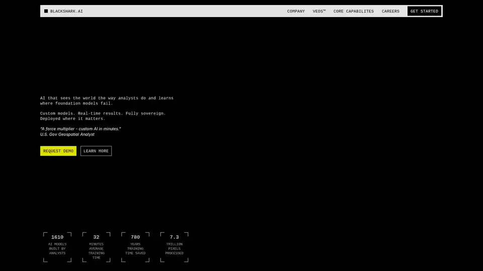
- Train Custom AI Models: Allows analysts to build custom detection models quickly, averaging around 32 minutes for training.
- Detect Features: Extracts features across any imagery, enabling classification, monitoring, and mapping with precision.
- Reconstruct 3D Environments: Transforms detection results into 3D terrain, generating Unreal-ready environments at scale.
- Export Data: Integrates into existing GIS and sovereign workflows.
The platform processes trillions of pixels, offering significant time savings in AI model development.
Who is BLACKSHARK.AI for?
BLACKSHARK.AI caters to various sectors:
- Analysts: Train custom detection models, extract features, classify, monitor, and map with mission precision, and deploy into existing GIS and sovereign workflows.
- Simulation Teams: Reconstruct 3D terrain, generate Unreal-ready environments, power visual sensor testbeds, and procedurally enrich any geospatial source.
Industries Served:
- Government
- Autonomy
- Enterprise
- Infrastructure
Key Features and Benefits
- Sovereign Intelligence: Custom AI models provide real-time results, fully sovereign and deployable where needed.
- AI Model Training: Analysts can build AI models tailored to their specific needs in minutes.
- Pixel Agnostic: Works with satellite, aerial, drone, LIDAR, and DSM data.
- Multi-Source Fusion: Fuses data from multiple sources into a unified workflow.
- Adaptable to Missions: Suitable for national defense, urban planning, and wildfire response.
- Model Reusability: Trained models can be reused, shared, and adapted across domains.
- Cloud Optional: Can be deployed on cloud, air-gapped, or tactical edge environments.
Why Choose BLACKSHARK.AI?
- Rapid AI Model Development: Train custom models in minutes.
- Comprehensive Data Handling: Ingests and processes various imagery and sensor data.
- Versatile Applications: Suitable for multiple domains and missions.
- Integration Capabilities: Seamlessly integrates with existing GIS and sovereign workflows.
What others say
Anne Arundel County's GIS Division highlights the impact of BLACKSHARK.AI's technology in improving workflows and equipping teams with timely, reliable, and precise data to support essential services.
How to get started with BLACKSHARK.AI
To explore the capabilities of BLACKSHARK.AI, you can request a demo through their website. This will allow you to understand how VEOS™ can be integrated into your workflows and infrastructure.
Strategic Capabilities
BLACKSHARK.AI is built for those who need answers from imagery fast. Their mission is to make spatial intelligence accessible for anyone, for anything, at any scale.
Tags Related to BLACKSHARK.AI